
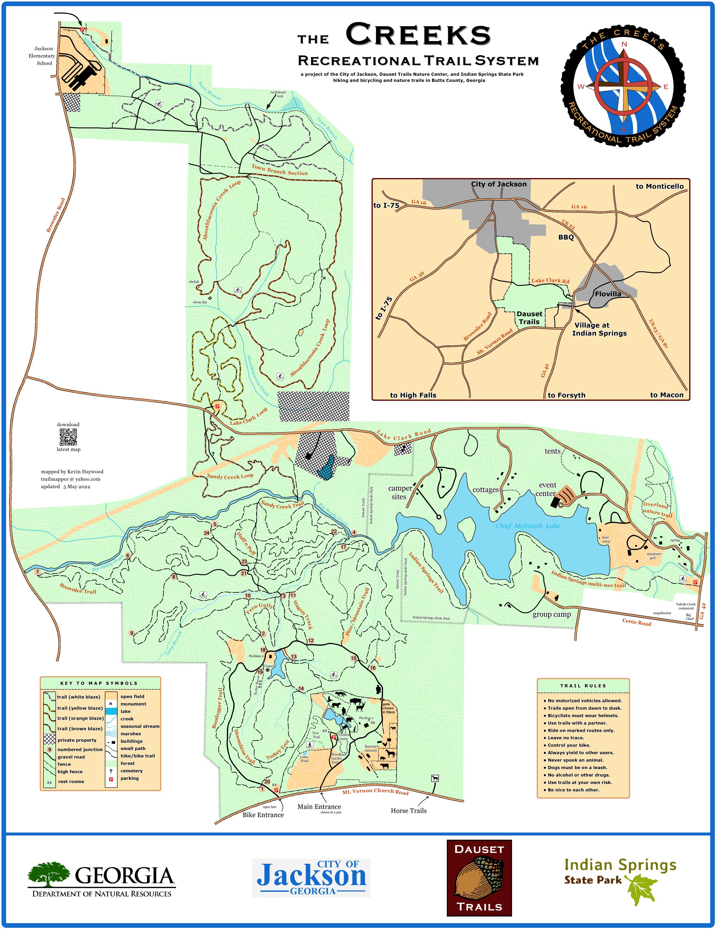
Hike and Bike Explore 20 miles of scenic trails on foot or mountain bike. Beginner to advanced levels. Trails span natural terrain from bottom land to steep slopes. Dogs are allowed on leash. bikeandhikemap with distances
The Creeks Recreational Trail System Map
Hike or Bike from the city of Jackson to Indian Springs State Park! This new trail system adds 10 miles to our existing trails providing 30 total miles. There are new Trailheads at: Brownlee Rd. beside Jackson Elementary School and Lake Clark Rd. Scan QR code posted throughout system for The Creeks map. Dogs are allowed on leash.

Horse Explore 5.75 miles of scenic trails on foot or horse. No bikes allowed. This trail is a loop and can be ridden clockwise or counter clockwise. A large Trailhead is available 1/2 mile east of our main gate off of Mt. Vernon Ch. Rd. for parking. horsetrailmap

Tree ID Learn to identify 31 native trees on this trail. Also learn about benefits of each tree for wildlife and people. This trail starts on the edge of the picnic area behind the playground. No pets allowed in this area. treeidmap

Nature Center See where the Visitors Center, picnic area with playground, Animal Trail (featuring mammals and birds of prey), reptiles, farm animals, and the woodland garden trail are located on this map. No pets allowed in this area. naturecenter